Porthdinllaen
A circular walk starting at Morfa Nefyn around the Porthdinllaen headland, visiting the small bay of Aber Geirch.
Distance: 5 miles (2 hours)
Parking: National Trust carpark in Morfa Nefyn (pay with cash or phone app)
Coordinates: 52.936354, -4.558534
Postcode: LL53 6DA
Last Checked: August 2024
Tide timetable: https://www.tideschart.com/United-Kingdom/Wales/Gwynedd/Nefyn/
The walk passes through and around Nefyn Golf Club. Please be courteous, remain alert and keep to the public footpaths. The path can be muddy in places so walking boots are recommended. There is an option to return to the carpark along Morfa Nefyn beach if the tide permits. Refreshments can be purchased at the Tŷ Coch Inn in Porthdinllaen, The Clffs Inn in Morfa Nefyn, or at the cafe opposite the carpark.
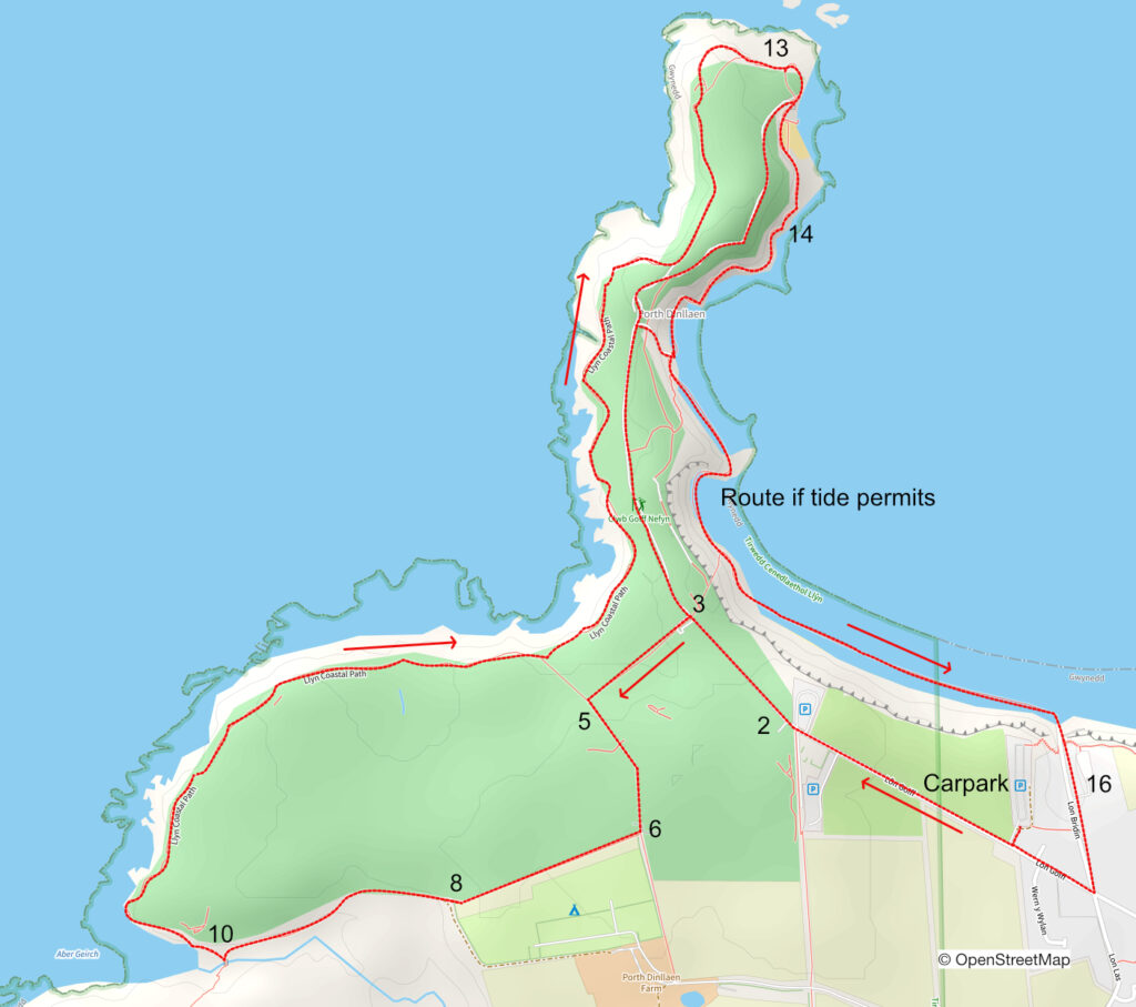
- Leave the carpark and turn right onto Lôn Golf.
- When you reach the golf course club house continue straight ahead and pass the 1st tee. Beware of flying golf balls!
- Take a left at the green shed following the footpath sign.
- Carefully cross the fairway and then follow the marker posts that leads between two fairways straight ahead to another footpath sign.
- Turn left and follow a path that rises gently through a cutting.
- Continue across a lane and through a gate, then immediately right through another gate.
- Continue ahead with the fence and golf course on your right.
- At end of the field pass through a gate and continue skirting the golf course.
- The path bend to the left and descends on a path that’s muddy in places.
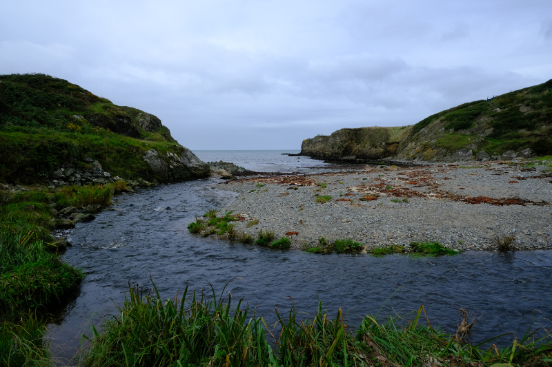
- Ignore the footbridge and take the coastal path on the right once you’ve stopped for a while at Aber Geirch. There is a short steep climb to kissing gate.
- The walk now follows the coastal path around the perimeter of the golf course.
- Follow the path and head towards the coast guard watch tower at the tip of the headland.
- The path passes behind the tower and then leads to the Lifeboat station carpark. At this point you have an option. You can return to the clubhouse along the upper path and then retrace your steps back to the carpark. This is the easier route. However, if the tide permits, the coastal path descends to the left past the Lifeboat station. This path is a more challenging as it is uneven and crosses a rocky beach. If you choose to take the more challenging route route…
- Follow the coastal path along the edge of the sea to Porthdinllaen and enjoy refreshments at the Tŷ Coch Inn.
- If the tide permits, continue along the beach from Porthdinllaen until reaching the access road Lôn Bridin. If not, take the road that ascends behind Tŷ Coch Inn to the golf course. At the top head left to the club house and retrace your steps back to the carpark.
- Ascend Lôn Bridin passing the Cliffs Inn on the left.
- Turn right at the junction with Lôn Golf and return to the carpark.